In 1906 San Diego businessman John D. Spreckels announced a railroad east from San Diego to the Imperial Valley. Engineers called it “the Impossible Railroad”: the route dipped into Mexico through Tijuana and Tecate, came back into the United States and dropped through Carrizo Gorge, an 11-mile stretch that alone needed 17 tunnels. Spreckels drove the golden spike in Carrizo Gorge on 15 November 1919, twelve years and about $18 million after work began, and the San Diego & Arizona ran through to El Centro.
Trains began downtown at San Diego’s Union Station, which the SD&A shared with the Santa Fe. From there the line ran south past National City and Chula Vista, crossed the Tijuana River into Mexico, and looped up through Tijuana, Valle Redondo and Tecate. It came back into the United States at Campo, inside Tunnel 4, and topped out at Tecate Divide, 3,660 feet up, before dropping to Jacumba. The map goes all the way to San Diego, so you can run the whole climb from the coast.
The gorge kept fighting back. In March 1932 a slide wrecked Tunnel 15, and instead of digging again the railroad built around it: the Goat Canyon Trestle, a curved, all-wood trestle finished in 1933, roughly 600 to 750 feet long depending on the source and about 186 to 200 feet high, often called the largest all-wood trestle in the world. Southern Pacific bought the line in 1932 and ran it as the San Diego & Arizona Eastern. Passenger trains ended in 1951, and the desert line has been out of service since 2008.
This map follows that desert line: from San Diego and Table Mountain to Jacumba, with its depot, coaling tower and engine house, past the Goat Canyon flag stop and over the big curved trestle into Carrizo Gorge, then out across the desert to Plaster City and El Centro. The places are named for the real route; the industries are made up for gameplay. The video below shows a few trains crossing it.
Specifications
Version: 1.0.1 · Download size: about 1.59 GB · Scenery: a big curved timber trestle, more canyon trestles, Jacumba town with its water tower, open country
How to get it
Available to every Greencoast Studios Patreon member, at any tier: connect your membership in the Greencoast Studios Updater to install it.
Requirements
Railroader 0.6 and the Greencoast Studios Updater, which installs everything the map needs. Close Railroader before installing, and back up any saves that use the map before updating.
In 1906 San Diego businessman John D. Spreckels announced a railroad east from San Diego to the Imperial Valley. Engineers called it “the Impossible Railroad”: the route dipped into Mexico through Tijuana and Tecate, came back into the United States and dropped through Carrizo Gorge, an 11-mile stretch that alone needed 17 tunnels. Spreckels drove the golden spike in Carrizo Gorge on 15 November 1919, twelve years and about $18 million after work began, and the San Diego & Arizona ran through to El Centro.
Trains began downtown at San Diego’s Union Station, which the SD&A shared with the Santa Fe. From there the line ran south past National City and Chula Vista, crossed the Tijuana River into Mexico, and looped up through Tijuana, Valle Redondo and Tecate. It came back into the United States at Campo, inside Tunnel 4, and topped out at Tecate Divide, 3,660 feet up, before dropping to Jacumba. The map goes all the way to San Diego, so you can run the whole climb from the coast.
The gorge kept fighting back. In March 1932 a slide wrecked Tunnel 15, and instead of digging again the railroad built around it: the Goat Canyon Trestle, a curved, all-wood trestle finished in 1933, roughly 600 to 750 feet long depending on the source and about 186 to 200 feet high, often called the largest all-wood trestle in the world. Southern Pacific bought the line in 1932 and ran it as the San Diego & Arizona Eastern. Passenger trains ended in 1951, and the desert line has been out of service since 2008.
This map follows that desert line: from San Diego and Table Mountain to Jacumba, with its depot, coaling tower and engine house, past the Goat Canyon flag stop and over the big curved trestle into Carrizo Gorge, then out across the desert to Plaster City and El Centro. The places are named for the real route; the industries are made up for gameplay. The video below shows a few trains crossing it.
Specifications
Version: 1.0.1 · Download size: about 1.59 GB · Scenery: a big curved timber trestle, more canyon trestles, Jacumba town with its water tower, open country
How to get it
Available to every Greencoast Studios Patreon member, at any tier: connect your membership in the Greencoast Studios Updater to install it.
Requirements
Railroader 0.6 and the Greencoast Studios Updater, which installs everything the map needs. Close Railroader before installing, and back up any saves that use the map before updating.
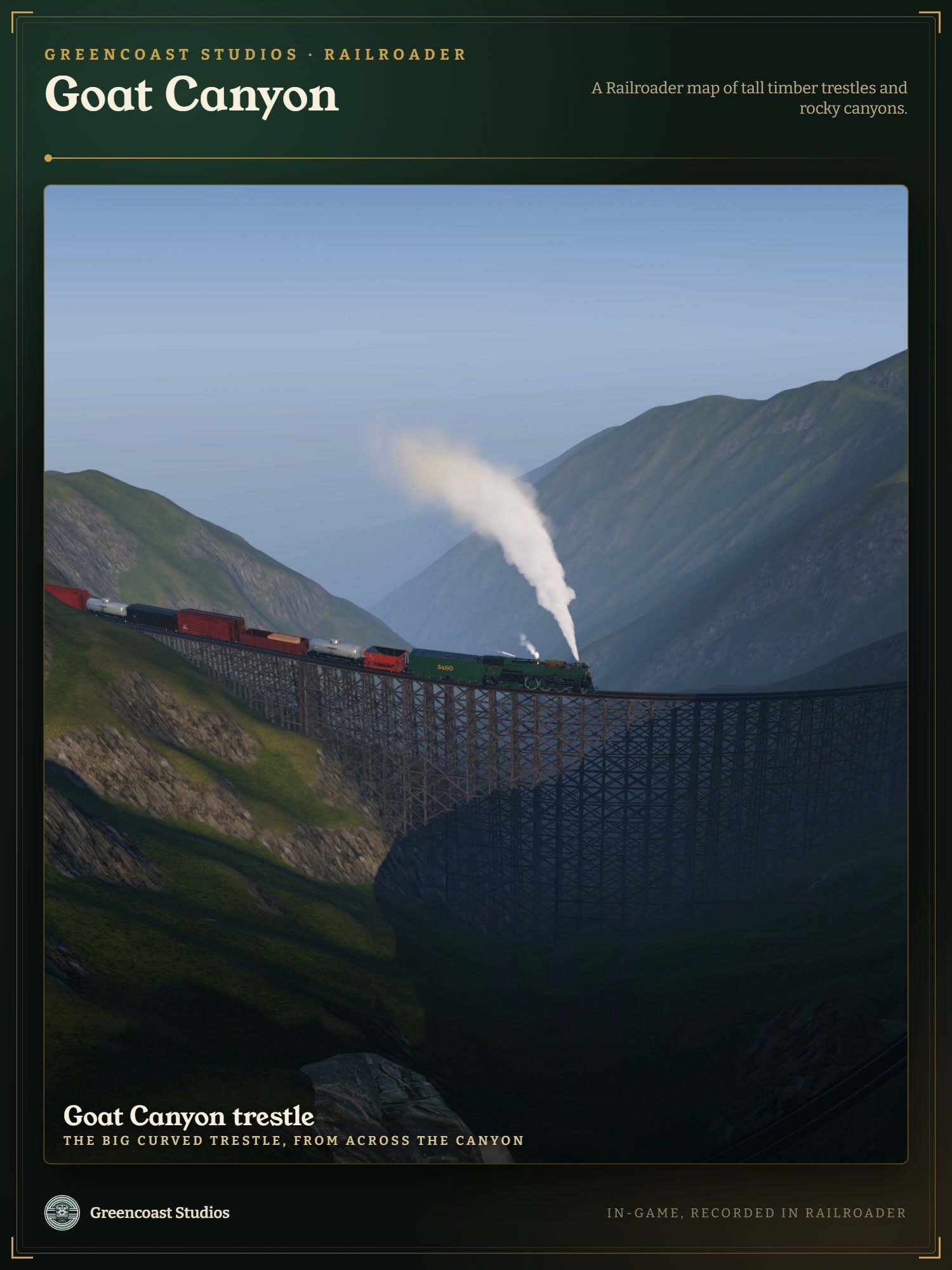 Image 1 of 6
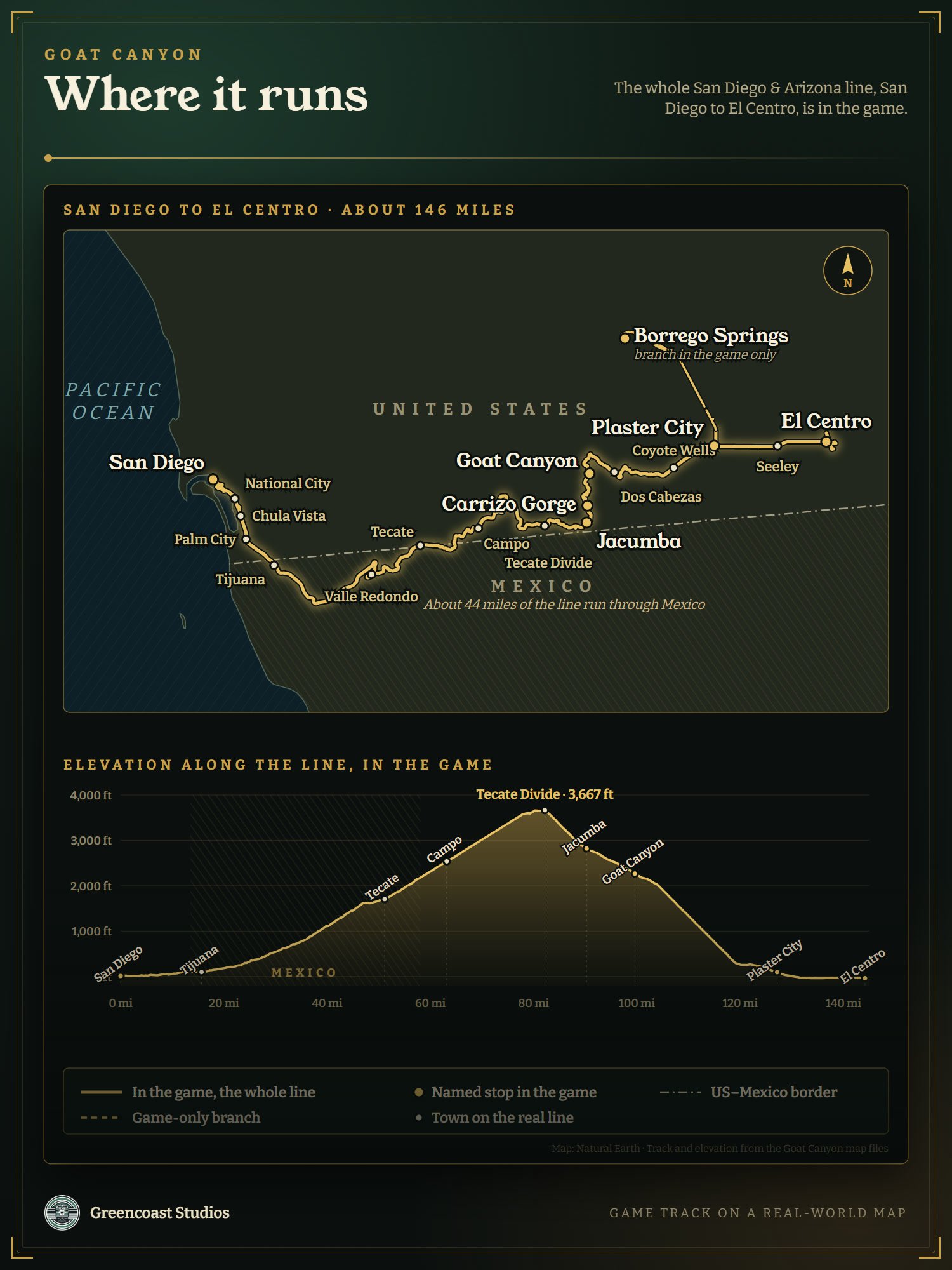 Image 2 of 6
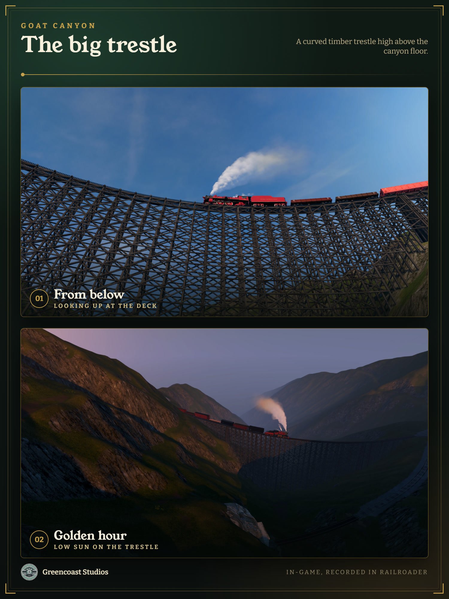 Image 3 of 6
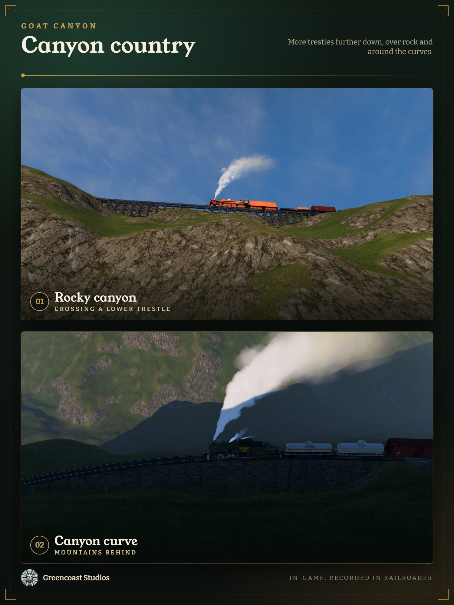 Image 4 of 6
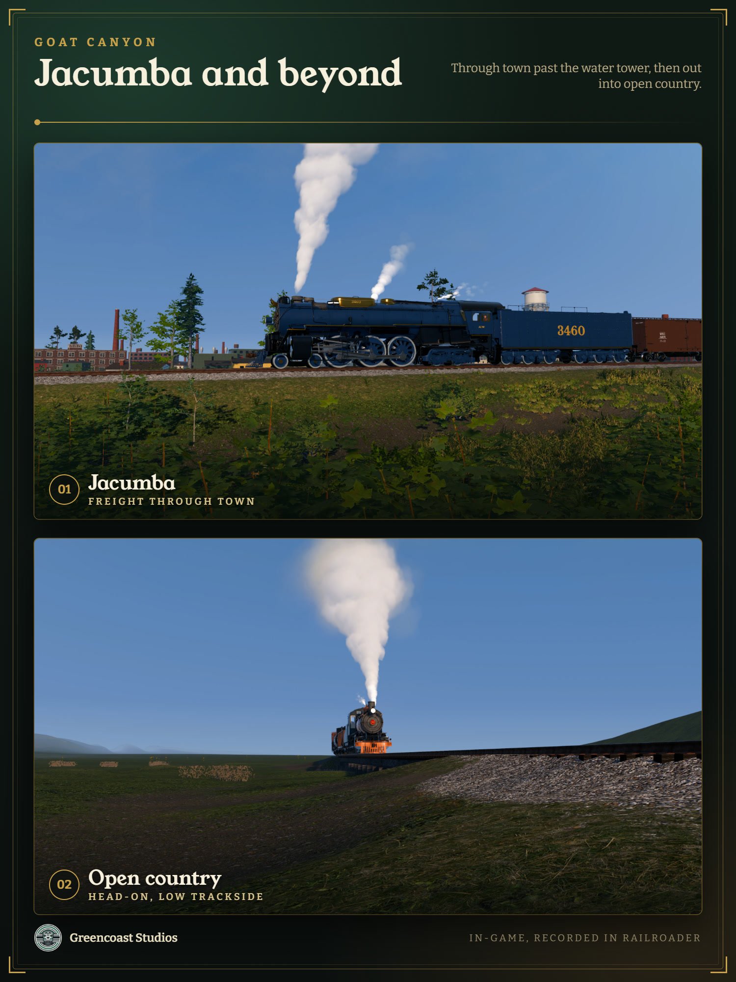 Image 5 of 6
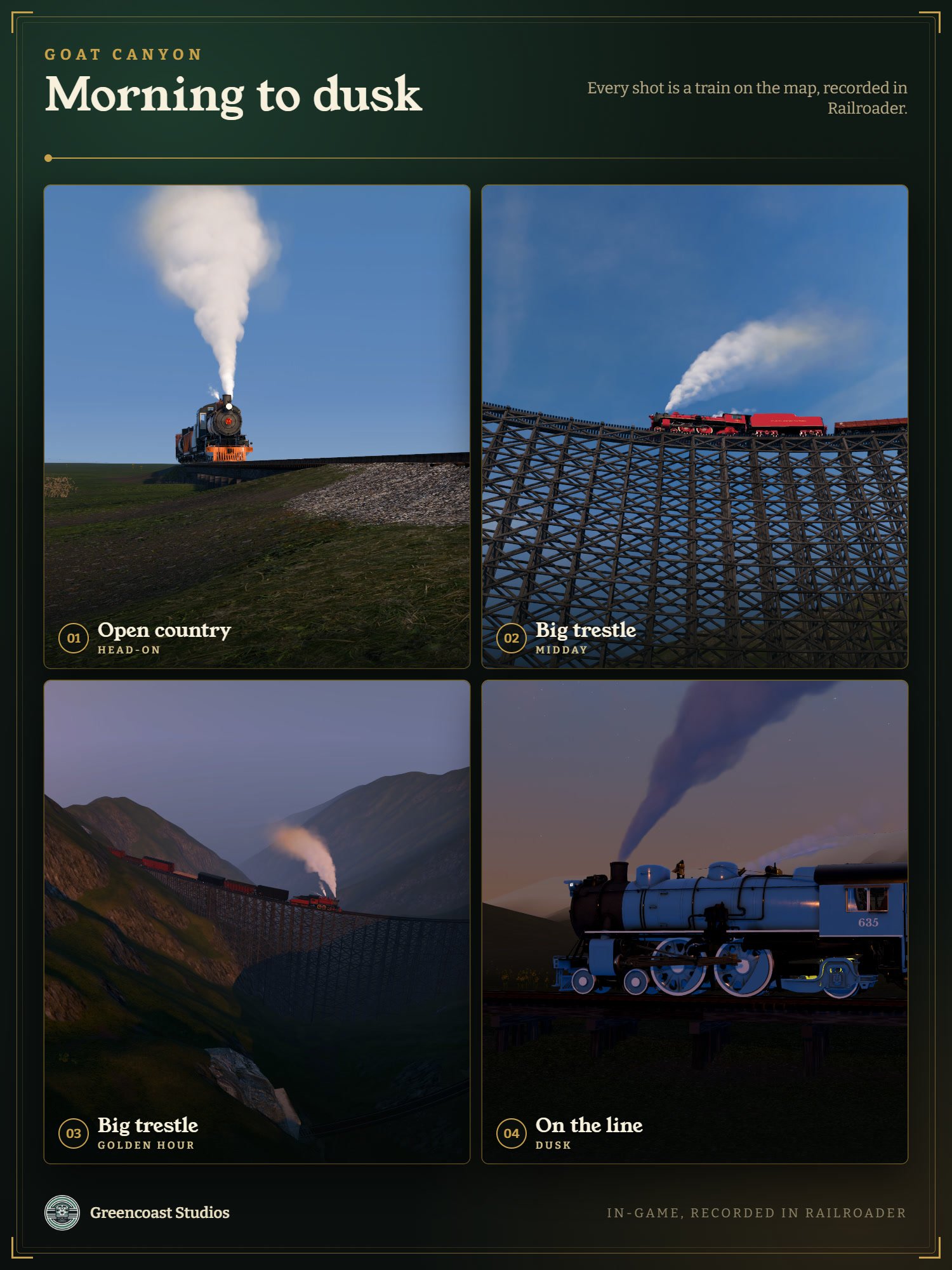 Image 6 of 6